A three-day linear trail starting in the village of Bweeng, County Cork, the Blackwater Way - Duhallow route follows local roads for 21km of the total 67km. This scenic route ends in Clonkeen, County Kerry.
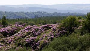
In addition to surfaced road, expect mountain flanks, forest track, bog roads, moorland, field paths and fantastic views too. Naturally, many of the off-road sections can be muddy in wet weather.
Easiest between Bweeng and Nad Bog, and Millstreet to Croohig’s Crossroads; the route is more moderate between
Nad Bog, Macroom/Millstreet Road and Millstreet itself.
The most challenging section comes at the last leg, Croohig’s Crossroads (Ballydaly) to Shrone. During the trail’s final 15km there’s a climb of 560m under Caherbarnagh and the Paps but no significant ascents elsewhere.
Rest and refreshment can be found in Mallow, near the trail’s start and Millstreet, at its later stages.
Dogs are strictly forbidden on this trail.
Trail details
- Type:
- Long Distance Waymarked Way
- Location:
- Blackwater Bweeng Shrone
- Grade:
- Strenuous
- Format:
- Linear
- Length:
- 73.90km
- Ascent:
- 560m
- Dogs allowed:
- No
Clonkeen Parking W11048 82616
Croohig’s Crossroads W 22732 89579
Millstreet W 26901 90276 or Claragh Road W 26773 89854
Mushera St. John’s Well W 32140 85719 or End of Mushera W 34975 86168
Boggeragh at forestry entrance W 42432 87059
Mossy bed W 45236 87346
Glenaknockane W 44162 88482
French’s Road W 47003 88791 and W 46463 88761
Bweeng W 49960 88589
- The views are particularly magnificent from the high ridges along the Mushera, Claragh and Caherbarnagh mountains.
