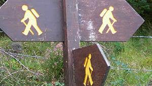
Taking three days to complete, this linear trail connects Ballyconnellan, County Sligo with Dromahair, County Leitrim and showcases magnificent Wild Atlantic Way scenery along the way.
The Sligo Way treats walkers to unparalleled vistas in the east over to Ben Bulben, north across Donegal Bay to Sliabh Liag and west to the Nephin Mountain range from the high moorland in the Ox Mountains. Towards the trail’s end, you’ll enjoy pleasant woodland and lakeside stretches too.
The terrain of this moderate 80km route consists mainly of forest tracks and ride lines, quiet side roads, and open moorland paths - often wet and boggy in places.
The Sligo Way has no significant climbs, with the entire route’s aggregate ascent only 900m. There are no accommodation options available for about the first 40km of the route, but plenty thereafter.
Trail details
- Type:
- Long Distance Waymarked Way
- Location:
- Laragan Dromahair
- Grade:
- Moderate
- Format:
- Linear
- Length:
- 78.50km
- Ascent:
- 890m
- Dogs allowed:
- No
At Start - at Largan Church
At End - in Dromahair village
Also at Lough Easkey G 44901 23733; Union Wood G 69313 29477; Ladies Brae G 53176 29046; Slish Wood G 73878 31387 and Innisfree G 77000 32849
On street car parking available in Coolaney, Collooney and Dromahair villages
- Along the way you’ll encounter an ancient crannóg or early lake dwelling on Lough Talt and some fascinating Megalithic tombs, which are abundant in west Sligo.
- As well as rugged mountain stretches, this trail skirts picturesque lake and woodland areas by Lough Easkey, Ballygawley Woods, Lough Lumman and Lough Gill.
- Lough Gill is home to the very island that poet WB Yeats was so charmed by, he penned The Lake Isle of Innisfree about it.
